JSU Lamson Maps
Item set
- Title
- JSU Lamson Maps
Items
-
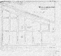 Map of Willard Shawnee County, Kansas, showing school district Ed. 114, date unknown. Case Data and Exhibits for Brown III, a relitigation of Brown v. Topeka Board of Education (1954) that corrected resegregation issues caused by open enrollment school choice in 1992. Map of Willard Shawnee County, Kansas, showing school district Ed. 114.
 -
 Map of Auburn, Shawnee County, Kansas, showing school district Ed. 151, date unknown. Case Data and Exhibits for Brown III, a relitigation of Brown v. Topeka Board of Education (1954) that corrected resegregation issues caused by open enrollment school choice in 1992. Map of Auburn, Shawnee County, Kansas, showing school district Ed. 151.
 -
 Topeka Area Metropolitan Map Series (Map Sheet M-26 3) with hand drawn markings by William Lamson. Case Data and Exhibits for Brown III, a relitigation of Brown v. Topeka Board of Education (1954) that corrected resegregation issues caused by open enrollment school choice in 1992. Topeka Area Metropolitan Map Series (Map Sheet L-26 3) with hand drawn markings by William Lamson marking school district boundaries.
 -
 Topeka Area Metropolitan Map Series (Map Sheet M-25 2) with hand drawn markings by William Lamson. Case Data and Exhibits for Brown III, a relitigation of Brown v. Topeka Board of Education (1954) that corrected resegregation issues caused by open enrollment school choice in 1992. Topeka Area Metropolitan Map Series (Map Sheet L-25 2) with hand drawn markings by William Lamson marking school district boundaries.
 -
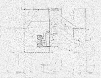 Topeka Area Metropolitan Map Series (Map Sheet L-27 5) with hand drawn markings by William Lamson. Case Data and Exhibits for Brown III, a relitigation of Brown v. Topeka Board of Education (1954) that corrected resegregation issues caused by open enrollment school choice in 1992. Topeka Area Metropolitan Map Series (Map Sheet L-27 5) with hand drawn markings by William Lamson marking school district boundaries.
 -
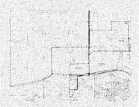 Topeka Area Metropolitan Map Series (Map Sheet L-25 1) with hand drawn markings by William Lamson. Case Data and Exhibits for Brown III, a relitigation of Brown v. Topeka Board of Education (1954) that corrected resegregation issues caused by open enrollment school choice in 1992. Topeka Area Metropolitan Map Series (Map Sheet L-25 1) with hand drawn markings by William Lamson marking school district boundaries.
 -
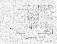 Topeka Area Metropolitan Map Series (Map Sheet L-26 4) with hand drawn markings by William Lamson. Case Data and Exhibits for Brown III, a relitigation of Brown v. Topeka Board of Education (1954) that corrected resegregation issues caused by open enrollment school choice in 1992. Topeka Area Metropolitan Map Series (Map Sheet L-26 4) with hand drawn markings by William Lamson marking school district boundaries.
 -
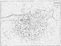 City of Topeka, Kansas Official Map, 1966-1967, with hand drawn markings by William Lamson. Case Data and Exhibits for Brown III, a relitigation of Brown v. Topeka Board of Education (1954) that corrected resegregation issues caused by open enrollment school choice in 1992. The map depicts the city of Topeka from 1966-1967 and includes hand drawn markers from William Lamson marking several structures and population shifts.
 -
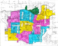 Official Map of City of Topeka, KS and Vicinity: Proposed Junior High School Attendance Areas, 1974-1975, with attendance areas colored in by William Lamson Case Data and Exhibits for Brown III, a relitigation of Brown v. Topeka Board of Education (1954) that corrected resegregation issues caused by open enrollment school choice in 1992. The map shows Proposed Junior High School Attendance Areas for Topeka Public Schools for 1974-1975. William Lamson colored each area with pens and marked the schools.
 -
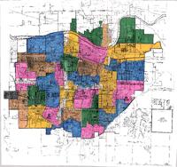 Map of Topeka, Kansas: Proposed Elementary Attendance Areas, 1974-1975, with attendance areas colored in by William Lamson. Case Data and Exhibits for Brown III, a relitigation of Brown v. Topeka Board of Education (1954) that corrected resegregation issues caused by open enrollment school choice in 1992. The map shows the Proposed Elementary Attendance Areas for Topeka Public Schools for 1974-1975. William Lamson colored in each area with pens and marked the schools.
 -
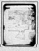 A map of Topeka, Kansas showing several landmarks and points of interest in the city, date unknown. Case Data and Exhibits for Brown III, a relitigation of Brown v. Topeka Board of Education (1954) that corrected resegregation issues caused by open enrollment school choice in 1992. The map shows landmarks and points of interest, such as Washburn Municipal University; Central Park; the Topeka Country Club; and the Kansas National Guard base.
 -
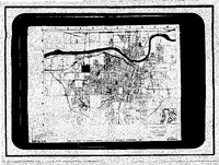 Map of Topeka, Kansas, showing residential neighborhood boundaries. Created by J.C. Sargent Company, Inc. with hand drawn markings by William Lamson. Date unknown. Case Data and Exhibits for Brown III, a relitigation of Brown v. Topeka Board of Education (1954) that corrected resegregation issues caused by open enrollment school choice in 1992. The map was created by J.C. Sargent Company, Inc. and shows residential areas in Topeka, Kansas, with markings by William Lamson marking several areas and streets.
 -
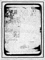 Map of Topeka, Kansas, showing areas annexed by the city and the new city limit boundaries, date unknown. Case Data and Exhibits for Brown III, a relitigation of Brown v. Topeka Board of Education (1954) that corrected resegregation issues caused by open enrollment school choice in 1992. The legend includes Boundary of the city of Topeka prior to annexation; platted areas annexed; areas excepted from annexation; and new city limits.
 -
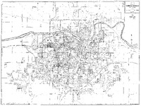 City of Topeka, Kansas Official Map, 1954, with hand drawn markings by William Lamson. Case Data and Exhibits for Brown III, a relitigation of Brown v. Topeka Board of Education (1954) that corrected resegregation issues caused by open enrollment school choice in 1992. The map depicts the city of Topeka from 1954 and includes hand drawn markers from William Lamson marking several structures and population shifts.
 -
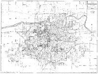 City of Topeka, Kansas Official Map, 1964, with hand drawn markings by William Lamson. Case Data and Exhibits for Brown III, a relitigation of Brown v. Topeka Board of Education (1954) that corrected resegregation issues caused by open enrollment school choice in 1992. The map depicts the city of Topeka from 1964 and includes hand drawn markers from William Lamson marking several structures and population shifts.
 -
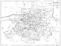 City of Topeka, Kansas Official Map, 1965, with hand drawn markings by William Lamson and a hand written note that says "Junior." Case Data and Exhibits for Brown III, a relitigation of Brown v. Topeka Board of Education (1954) that corrected resegregation issues caused by open enrollment school choice in 1992. The map depicts the city of Topeka from 1965 and includes hand drawn markers from William Lamson marking several structures and a handwritten note that says "Junior."
 -
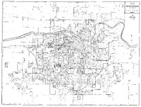 City of Topeka, Kansas Official Map, 1966-1967, with hand drawn markings by William Lamson and a hand written note that says "Junior." Case Data and Exhibits for Brown III, a relitigation of Brown v. Topeka Board of Education (1954) that corrected resegregation issues caused by open enrollment school choice in 1992. The map depicts the city of Topeka from 1966-1967 and includes markers by William Lamson marking several structures and a note that says “Junior, 1 Change.”
 -
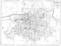 City of Topeka, Kansas Official Map, 1967-1968, with hand drawn markings by William Lamson and a hand written note that says "Junior." Case Data and Exhibits for Brown III, a relitigation of Brown v. Topeka Board of Education (1954) that corrected resegregation issues caused by open enrollment school choice in 1992. The map depicts the city of Topeka from 1967-1968 and includes markers by William Lamson marking several structures and a note that says “Junior, 1 Change.”
 -
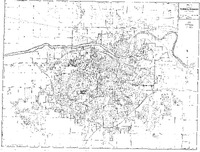 City of Topeka, Kansas Official Map, 1968-1969, with hand drawn markings by William Lamson and a hand written note that says "Junior, 1 Change." Case Data and Exhibits for Brown III, a relitigation of Brown v. Topeka Board of Education (1954) that corrected resegregation issues caused by open enrollment school choice in 1992. The map depicts the city of Topeka from 1968-1969 and includes markers by William Lamson marking several structures and a note that says “Junior, 1 Change.”
 -
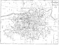 City of Topeka, Kansas Official Map, 1969-1970, with hand drawn markings by William Lamson and a hand written note that says "Junior, 1 Change." Case Data and Exhibits for Brown III, a relitigation of Brown v. Topeka Board of Education (1954) that corrected resegregation issues caused by open enrollment school choice in 1992. The map depicts the city of Topeka from 1969-1970 and includes markers by William Lamson marking several structures and a note that says “Junior, 1 Change.”
 -
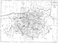 City of Topeka, Kansas Official Map, 1970-1971, with hand drawn markings by William Lamson marking several structures. Case Data and Exhibits for Brown III, a relitigation of Brown v. Topeka Board of Education (1954) that corrected resegregation issues caused by open enrollment school choice in 1992. William Lamson handwritten note on top right corner: "1970-1" with several structures on the map hand marked by Lamson.
 -
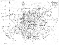 City of Topeka, Kansas Official Map, 1971-1972, with hand drawn markings by William Lamson and a hand written note that says "No Change." Case Data and Exhibits for Brown III, a relitigation of Brown v. Topeka Board of Education (1954) that corrected resegregation issues caused by open enrollment school choice in 1992. The map depicts the city of Topeka from 1971-1972 and includes markers by William Lamson marking several structures and a handwritten note that says “No Change.”
 -
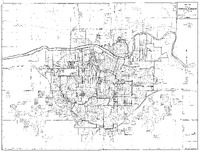 City of Topeka, Kansas Official Map, 1972-1973, with hand drawn markings by William Lamson and a hand written note that says "No Change." Case Data and Exhibits for Brown III, a relitigation of Brown v. Topeka Board of Education (1954) that corrected resegregation issues caused by open enrollment school choice in 1992. The map depicts the city of Topeka from 1972-1973 and includes markers by William Lamson marking several structures and a handwritten note that says “No Change.”
 -
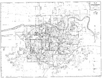 City of Topeka, Kansas Official Map, 1973-1974, with hand drawn markings by William Lamson to indicate population shifts. Case Data and Exhibits for Brown III, a relitigation of Brown v. Topeka Board of Education (1954) that corrected resegregation issues caused by open enrollment school choice in 1992. Hand drawn markings by William Lamson to indicate population shifts within the city of Topeka from 1973-1974.
 -
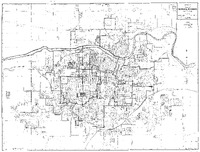 City of Topeka, Kansas Official Map, 1974-1975, with hand drawn markings by William Lamson and a hand written note that says "No Change." Case Data and Exhibits for Brown III, a relitigation of Brown v. Topeka Board of Education (1954) that corrected resegregation issues caused by open enrollment school choice in 1992. The map depicts the city of Topeka from 1974-1975 and includes markers by William Lamson marking several structures and a handwritten note that says “No Change.”