-
Title
-
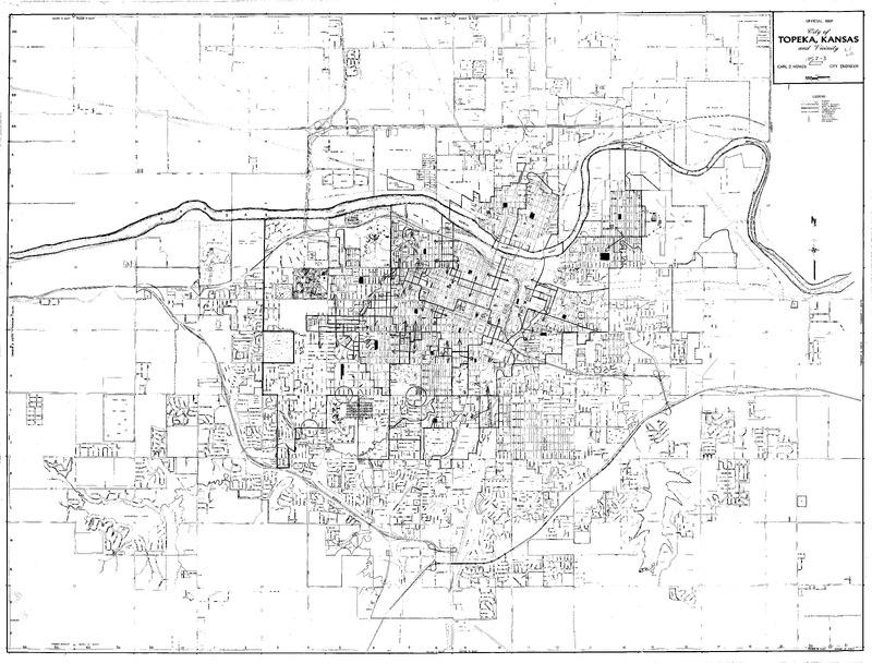
City of Topeka, Kansas Official Map, 1952-1953, with hand drawn markings by William Lamson.
-
Date
-
1952--1953
-
Contributor
-
William Lamson, 1941-1992
-
Description
-
Case Data and Exhibits for Brown III, a relitigation of Brown v. Topeka Board of Education (1954) that corrected resegregation issues caused by open enrollment school choice in 1992. The map depicts the city of Topeka from 1952-1953 and William Lamson hand marked each grade school, junior high school, and high school on the map.
-
Additional Subject
-
American Civil Liberties Union
-
Desegregation
-
Location
-
Topeka
-
Shawnee County
-
Kansas
-
United States
-
Type
-
Map
-
Measurements
-
37 in x 27.5 in
-
Format
-
JPEG
-
HBCU Identifier
-
mwchcac.ar.2022.map0427
-
HCAC Identifier
-
HCAC.JSU.0137
-
Rights
-
All rights held by the Margaret Walker Center. For permission to publish, distribute, or use this image for any other purpose, please contact Margaret Walker Center, Jackson State University, 601-979-3935 Attn: Center Director
-
Contributing Institution
-
Jackson State University
-
Language
-
English
-
About This Record
-
The HCAC public history focused digital archive cataloging is an ongoing process, and we may update this record as we conduct additional research and review. We welcome your comments and feedback if you have more information to share about an item featured on the site, please contact us at: HCAC-DigiTeam@si.edu


